


UNITY 1 Voting District, Piatt County, Illinois
About
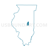
Outline

Summary
| Unique Area Identifier | 573965 |
| Name | UNITY 1 Voting District |
| County | Piatt County |
| State | Illinois |
| Area (square miles) | 18.06 |
| Land Area (square miles) | 18.06 |
| Water Area (square miles) | 0.00 |
| % of Land Area | 100.00 |
| % of Water Area | 0.00 |
| Latitude of the Internal Point | 39.83535530 |
| Longtitude of the Internal Point | -88.49055940 |
Maps


Graphs
Select a template below for downloading or customizing gragh for UNITY 1 Voting District, Piatt County, Illinois


Neighbors
Neighoring Voting District (by Name) Neighboring Voting District on the Map
- BEMENT 2 Voting District, Piatt County, IL
- GARRETT 2 Voting District, Douglas County, IL
- LOWE 1 Voting District, Moultrie County, IL
- SADORUS-IVESDALE Voting District, Champaign County, IL
- UNITY 2 Voting District, Piatt County, IL
Top 10 Neighboring County Subdivision (by Population) Neighboring County Subdivision on the Map
- Bement township, Piatt County, IL (1,893)
- Lowe township, Moultrie County, IL (1,723)
- Garrett township, Douglas County, IL (1,441)
- Unity township, Piatt County, IL (1,418)
- Sadorus township, Champaign County, IL (967)
Top 10 Neighboring Place (by Population) Neighboring Place on the Map
Top 10 Neighboring Unified School District (by Population) Neighboring Unified School District on the Map
- Atwood-Hammond Community Unit School District 39, IL (2,605)
- Bement Community Unit School District 5, IL (2,399)
Top 10 Neighboring State Legislative District Lower Chamber (by Population) Neighboring State Legislative District Lower Chamber on the Map
Top 10 Neighboring State Legislative District Upper Chamber (by Population) Neighboring State Legislative District Upper Chamber on the Map
Top 10 Neighboring 111th Congressional District (by Population) Neighboring 111th Congressional District on the Map
Top 10 Neighboring Census Tract (by Population) Neighboring Census Tract on the Map
- Census Tract 109, Champaign County, IL (9,302)
- Census Tract 9523, Douglas County, IL (5,559)
- Census Tract 9769, Moultrie County, IL (4,892)
- Census Tract 9547, Piatt County, IL (3,430)
Top 10 Neighboring 5-Digit ZIP Code Tabulation Area (by Population) Neighboring 5-Digit ZIP Code Tabulation Area on the Map
- 61911, IL (4,860)
- 61937, IL (2,022)
- 61813, IL (1,971)
- 61913, IL (1,684)
- 61929, IL (769)
- 61851, IL (436)